
The South Slough National Estuarine Research Reserve near Charleston is the Bay Area’s premier “back door” getaway, with many possibilities for walks as well as kayak, canoe or stand-up paddle board exploration. All offer a different perspective of the coastal wetlands, forests, and rivers that make up South Slough Reserve. A brochure and trail map is available online and at an outdoor rack at the Reserve’s interpretive center.
Set aside in 1974 as America’s first estuary preserve, South Slough protects more than 4800 acres of tidelands and coastal forest for research, education and limited recreation.
Estuaries are protected embayments where rivers meet the sea. The continual motion of ocean tides and upland runoff provides nutrients for a wide variety of plants and animals – from salt-tolerant grasses and plants to worms, clams and other tiny creatures buried in the mud.
Multitudes of young fish and crabs grow up here, and along with insects and amphibians, they provide a source of food for resident and migratory waterfowl and birds.
As mentioned, there are hiking trails and an interpretive center, and the waterways can be accessed from a couple of places. Admission is free and the trails are open year round for day-use. Leashed dogs are okay except on the dog-free North Trail. Most of the trails can be linked for longer walks and loops.
The interpretive center is open 10 a.m. to 4.p.m. Tuesdays through Saturdays. They offer workshops and presentations along with guided tours on land and waterways. There are also lots of programs for youngsters. Check the South Slough webpage or facebook, and watch for weekly notices in the Shopper.
The interpretive center and its adjacent parking area have been a hive of activity over the past few months, as crews carve out an expanded parking area. In addition to providing more parking, the expansion makes it easier for school buses and other larger vehicles to turn around. Meantime, inside the interpretive center, new exhibits have been added, and more are planned.
Despite the activity, though, all the excellent trails remain intact and open to public use, as noted above.
About 1 mile south of the interpretive center is Hinch Lane, with a mile-long gravel road to a popular paddler put in/take out. Here too is Wasson Creek trail system, currently being expanded and expected to be finished this summer, according to project manager Juliana Ruble.
And of course you don’t have to wait until then to enjoy South Slough – it’s fun in every season, and it’s right “out our back door!”
Getting There
From US 101 in Coos Bay or North Bend, follow signs to Charleston, State Parks, Ocean Beaches. Once in Charleston, head west on Cape Arago Highway. Just west of town, go left (S) on Seven Devils Rd., following the sign to South Slough Reserve and Bandon.
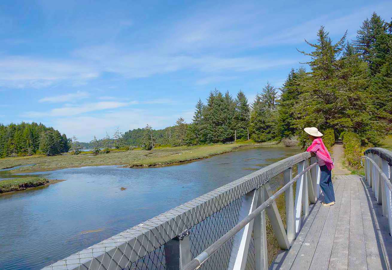
The road curves up into the hills, with clearcuts opening up vistas, while the growing-back forest hems in the road in other places. At 4.4 miles is the interpretive center, along with trails that can be made into loops. Park here or better yet drive down the road on the right (S) side of the interpretive center and follow it down to the Hidden Creek trailhead. This is a favorite trail, descending through thick stands of salal, Oregon grape and huckleberry, while overhead a classic mixed-species forest of cedar, fir, hemlock and spruce rocks gently in the breeze. A highlight is the Skunk Cabbage Walk, an elevated walkway that traverses a leafy sea of this distinctive and aromatic plant. Farther along is a two-level platform for wildlife viewing, where you might spot a stately blue heron or snow-white egret feeding along the mudflats. Here too decisions must be made: return the way you came, or return on the adjacent Big Cedar trail. Space limits here preclude much detail, so we’ll leave this special place for now and let the big trees rock and sigh in the breeze . . .
(Shopper columnist Tom Baake is author of regional guidebooks available at Books by the Bay and the visitor centers in North Bend and Coos Bay.)
