
While the rest of the country struggles with almost-unbelievable snowstorms and freezing temperatures, here on Oregon’s South Coast we’re dealing with our own weird weather. The season’s highest tides -- King Tides – arrived as predicted in late December and early January, only to be met by torrential wind, rain and storm runoff delivered via what weather reporters like to call atmospheric rivers. Then came nearly four weeks of warm and sunny weather. “It’s not even this nice in summer,” was a frequent comment, although blessedly missing was the pesky wind of summer. Bays, rivers and their estuaries were flat as mirrors.
Those same weather prognosticators remind us that a scant two years ago – and during previous times -- less-than-normal wintertime rainfall worried people about potential drought, only to be relieved by late rain. There for a while, though, places like the access road to Horsefall Beach in the Oregon Dunes were flooded well into late spring.
The return of precipitation last weekend helps rainfall totals a bit, but a false spring is emerging. For example, check out the already-blooming plum trees in North Bend’s Grant Circle and other places. Early daffodils are up as well.
But fair and warm weather just begs for enjoyment. Keep in mind, though, that it’s still technically winter, with reduced sunlight and an immediate chill when the sun goes down. So get an early start.
Fortunately for those in the Bay Area, there are lots of options for short walks and potential picnic outings. You don’t have to travel far to take in our prized scenery. Treks can range from the South Slough National Estuarine Research Reserve near Charleston to the Oregon Dunes to Bandon Beaches. Or visit such in-town places as Empire Lakes and North Bend’s trio of parks --Simpson, Winsor, and Ferry Road at the north end of town.
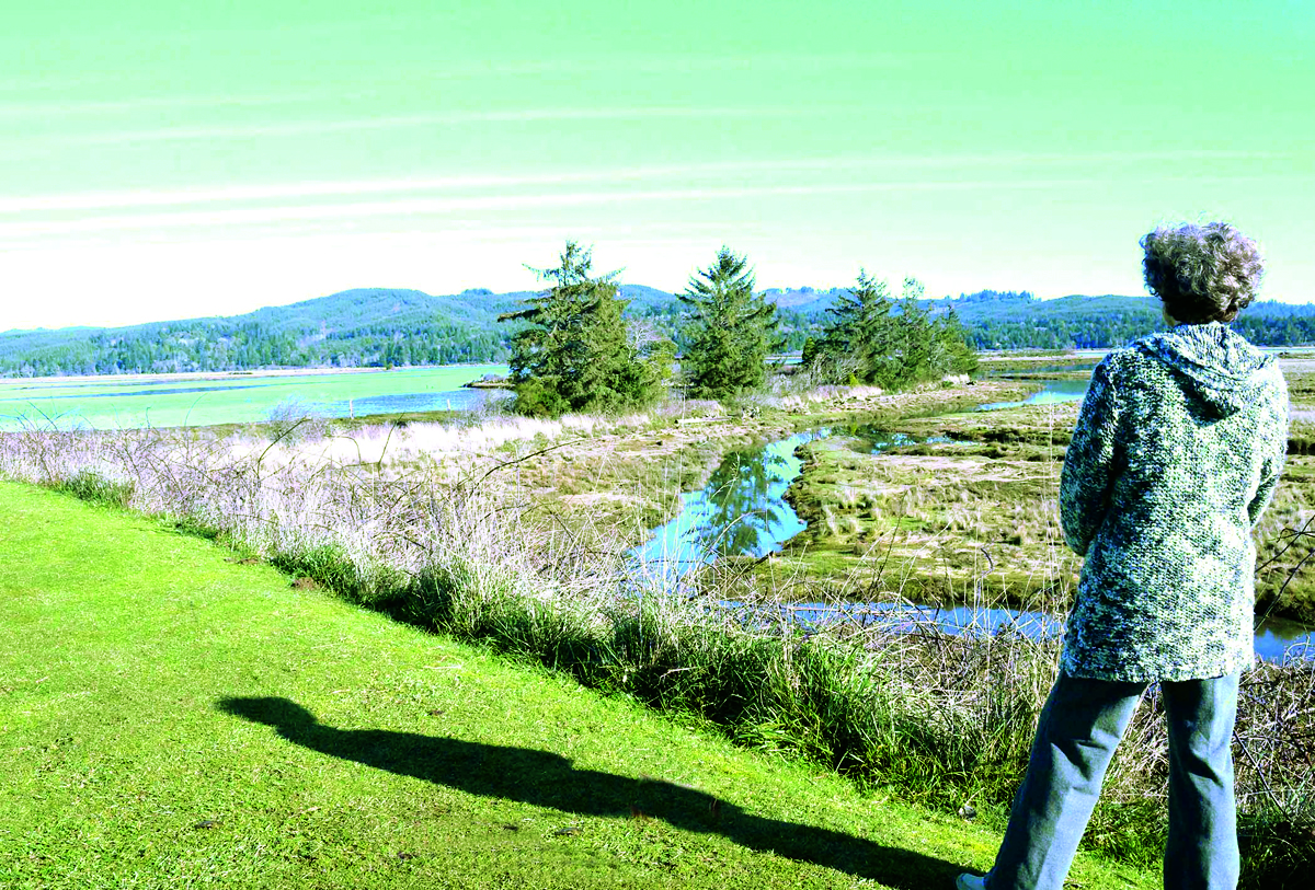
Another gem is the Millicoma Marsh Trail (MMT) system in Coos Bay’s Eastside district, just minutes from busy city streets. Trails go atop levees protecting fresh and saltwater wetlands, with impressive views clear up to McCullough Bridge and beyond, and braided through with waterways that sparkle in the sunlight. It’s also a primo place for bird watching, with many avian species residing here all year and others in migration.
Grassy and gravel trails are level and flat, with routine mowing courtesy the local school district. Other maintenance is performed during occasional work sessions by volunteers. MMT organizer Jamie Fereday said 63 people turned out for a recent work session, trimming overhanging branches and cutting back encroaching brush. Jamie credited District Operations Chief Kyle Gibbons of the Coos Forest Protective Association for rounding up volunteers.
The group also spread gravel left over from previous work sessions. Other volunteers came from the Oregon Bay Area Beautification (OBAB) group, which holds 2nd Saturday cleanups of Coos Bay and North Bend. Catie Loy, one of the group’s organizers, said their volunteers spread wood chips in muddy places on the main trail.
Also enjoying frequent visits to the trails are members of the Park Pack of Coos Bay & North Bend, which organizes “flash mob” walking events in the Bay Area. The group is a great source of information and inspiration for those seeking the safety of a group activity. Check out their Facebook group for details and to sign up to get notices of upcoming walks. For further inspiration, visit the MMT website at https://sites.google.com/view/millicoma-marsh/the-trails and click on Birds of the Marsh to see excellent photos of more than 60 kinds, both male and female. (The males are nearly always more colorful – the better to attract a mate!)
Getting There
From the “Y” intersection on US 101 at the south end of Coos Bay, follow the sign to Allegany, Coos River. Cross Isthmus Slough Bridge. Once across, bear left (N) on 6th Ave. and follow it 0.8 mile to a “T” intersection with D St. Turn left (W) on D St. and in 2 blocks turn right (N) on 4th Ave. In one block, park in a cobblestone lot above the ballfield or go down the driveway and park by the field. Walk east across the ballfield toward the scoreboard and you’ll see signs for the trail. You can take an out and back walk, or make loops..
Whichever route or location you choose during this “weird weather,” and whether you go with a group or solo, have fun exploring!
(Shopper columnist Tom Baake is author of the regional guidebook “Out Our Back Door” available at Books By the Bay in North Bend and the Coos Bay Visitor Center.
